Snowshoeing Kosciuszko
Kosciuszko National Park, NSW
Kosciuszko’s main range in winter - a totally different, crowd free-experience
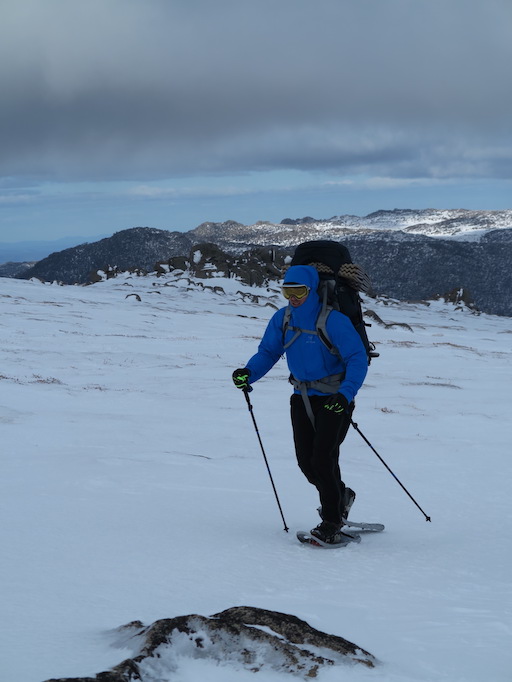
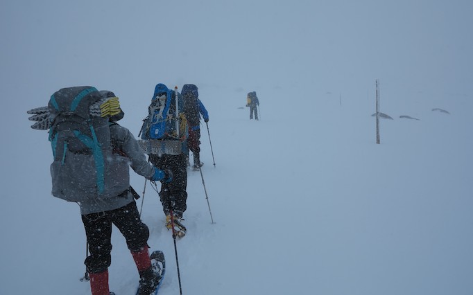
There’s nothing like plodding through a silent white world, rugged up warm against a chill wind, and witnessing the familiar landscape bleached and softened by a pristine blanket of snow. Ragged exhalation and the muffled crump of snowshoes, or swish of skis, are the only sounds besmirching the silence. Whether it’s a bluebird day or an eerie whiteout, the experience is uniquely thrilling.
Kosciuszko’s Main Range is one of Australia’s classic multi-day hikes, walked by thousands of people every year. The roughly 30km route takes in the summit of Mt. Kosciuszko (the highest point on mainland Australia at 2228m), then curls around past a couple of shimmering and iridescent lakes before crossing the Snowy River, here a mere trickle. Some knock it out in a day, while some take a leisurely three.
In summer, the area can get very busy. As well as regular bushwalkers, there are always groups attempting the Aussie 10 challenge (climbing the ten highest peaks in one push), ill-prepared day-trippers, and traffic of all shapes and sizes clogging the paved highway up Kozi. It can be a tad overbearing, but you can have a totally different, crowd-free experience by tackling the same circuit in the heart of winter.
-
Location
Kosciuszko National Park, NSW
-
Distance
30km
-
Duration
2-3 Days
-
When to go
June to October
-
Sleeping
Camping or accomodation
-
Permit required
None
Trip Highlights
- Having the highest point in mainland Australia all to yourself, a rare treat.
- Hunkering down in a cosy sleeping bag burrow while a blizzard rages outside your tent.
- Stopping off at the country’s premier ice climbing location, Blue Lake.
- Taking a cheeky downhill line off the ridge down to Club Lake (skiers only).
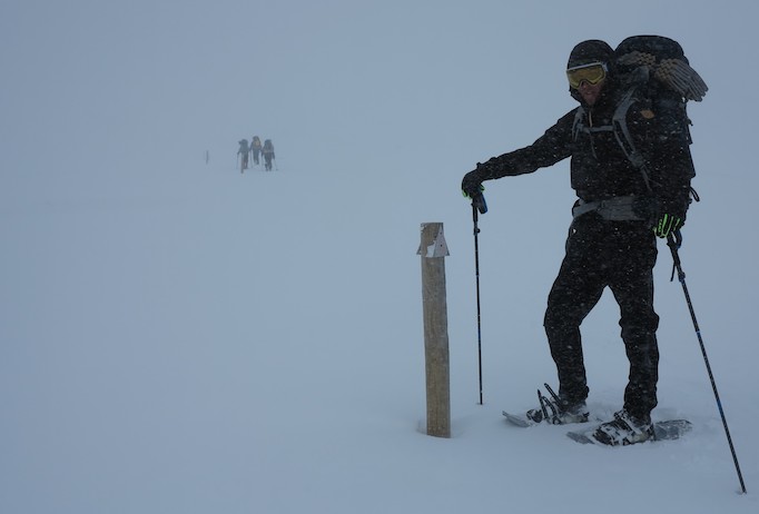
- The eerie inside-of-a-billiard-ball experience of a genuine white-out.
History
The Snowy Mountains have long been the epicentre of Australian snow sports, so winter trips here have an excellent pedigree. Interesting fact – the world’s first official ski club was founded in the small mining town of Kiandra, in the northern part of Kosciuszko National Park, in 1861. The Kiandra Snow Shoe Club survives to this day. Activity in the southern Thredbo region began around 1900, and the tops in winter were a popular excursion during the 1920s.
When to go
Short answer – when snow is on the ground. Climate change has been playing havoc with the seasons over the last couple of decades, and while snow cover can occur as early as April, it’s generally the beginning of June before there’s enough to guarantee good snowshoeing conditions on Kosciuszko’s Main Range. The season officially ends in October but good snow can often be found after that.
Access
There are a number of places to start/finish along the circuit. If you’re driving, Thredbo is a convenient and secure place to leave a car before slogging up the track beneath the chairlift.
A nicer option is Dead Horse Gap, from where the ascent to the Eagle’s Nest is more gentle and serene. Another possible starting point is Charlotte Pass, although access from Perisher is only by snow cat or shanks’ pony, i.e. a 9km walk-in. Perisher itself is (usually) accessible by road, although parking is limited, or take the Ski Tube from Bullocks Flat.
Costs
Entering Kosciuszko National Park is free, as is camping, so potentially the only expenditure is fuel and food. However, there are some possible peripheral costs. Parking charges apply in Perisher and Thredbo, and as the latter is within the national park, visitors must buy the $29 pass for their vehicles. To avoid parking at Perisher, Ski Tube tickets start at $41.
Equipment
Most of the clothing and equipment for this adventure should already be in your hiking wardrobe, but there are a few specialised items to consider:
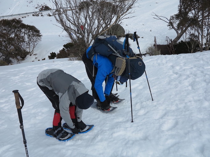
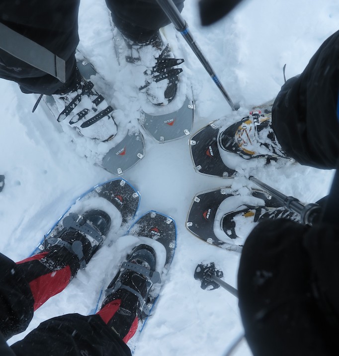
- Snow shoes or cross-country skis – Basic ones will do (outside of actual tennis racquets strapped to your boots). Something like the MSR Lightning Ascent is perfect.
- Poles – If you don’t already use trekking poles, you’ll need them when snowshoeing, for stability as much as load distribution. (PS – you’re after walking poles, not ski poles!)
- Tent – For this trip you’re going to need a four-season tent, for both heat retention and wind resistance. Snow-specific tents like the One Planet Goondie 2 Snow have double pole sleeves and a snow skirt. Importantly, you must know how to erect it so you don’t get caught out in a raging blizzard. Practice at home.
- Warm clothes – thermal layers, insulated jackets, waterproof shells, double socks, heat pads, beanie, gloves. You’re going to need it all.
- Sleeping Bag – There’s a huge variety in bodies’ resistance to cold, and some sleep warmer than others, but most people should be looking at a sleeping bag rated to at least -10°C. Consider boosting your bag with a thermal liner, and wear your beanie in bed!
- PLB – always carry a personal locator beacon.
- Gas – some brands of gas cope better with cold than others. Jetboil and MSR use a mixture of 80% isobutane/20% propane, which performs well.
- Backpack – to carry all this cold weather gear, you might need a larger pack than usual, at least 70 litres and maybe up to 100 litres.
Navigation
While you might usually be comfortable navigating with a phone app or handheld GPS unit, these are absolutely not sufficient for winter mountain navigation. Batteries don’t fare well in extreme temperatures and prominent landmarks won’t help you in a whiteout, so it’s essential to carry a backup paper map and compass.
Spatial Vision’s Kosciuszko Alpine Area is barely adequate at 1:50,000. Better to print out and laminate the NSW Lands Department Perisher Valley map (8525-2S). If starting from Thredbo or Dead Horse Gap, you may also need Chimneys Ridge (8524-1N).
Safety
Make no mistake, this area can be lethal. Disorientation and exposure are the biggest dangers, and snowshoe and cross-country ski parties, even experienced ones, regularly get lost and sometimes require rescuing.
Seaman’s Hut was erected in memory of Laurie Seaman, after he and his companion perished of exposure in a fierce storm in 1928. On the same site, in 1999, four snowboarders suffocated to death in a snow cave they’d built after their ventilation hole was blocked in the night by falling snow.
Tell somebody your plans, carry a PLB, stay warm and dry, don’t venture out in bad weather, and above all – know when to chuck it in and go home. The mountains will still be there next year.
Accomodation
Camping is prohibited within the catchment area of Blue Lake, Club Lake, Lake Cootapatamba, and Hedley Tarn, and within 30m of all other water. Also, don’t pitch your tent within 200m of Kozi summit, Charlotte Pass, Guthega or Crackenback chairlift. Apart from that, the tops are your oyster! Camp early and choose a sensible site, out of the wind but not beneath possible snow accumulation sites.
There are backcountry huts dotted around, but these are for emergency use only. If you feel like splashing out after a couple of nights under canvas, a range of accommodation options from budget to luxury await in town.
Useful links:
More Adventures like this
-
It’s no secret that the Blue Mountains and Wollemi National Parks together comprise an unmissable location for recreational canyoners, but a short distance away lies another canyoning playground wit...
Canyoning in Bungonia
Bungonia National Park, NSW
-
Hiked Kosciuszko's Main Range circuit in summer, and think it’s done and dusted? Think again! The same route in winter, in below-freezing temperatures, is a whole different story.
Snowshoeing Kosciuszko
Kosciuszko National Park, NSW
-
At 3033m, Mt Aspiring is the highest mountain in New Zealand outside of the Aoraki / Mt. Cook region. Challenging, yet achievable by anyone with a reasonable level of fitness, a few basic skills under...
Climbing Mt Aspiring
Mt Aspiring National Park, Otago, New Zealand
-
Australia's most famous multi-day hike, the Overland Track is 65 km, six-day trek through the heart of the Cradle Mountain-Lake St Clair National Park.
The Overland Track
Tasmania


