

The Overland Track
Tasmania


Australia's most famous multi day hike
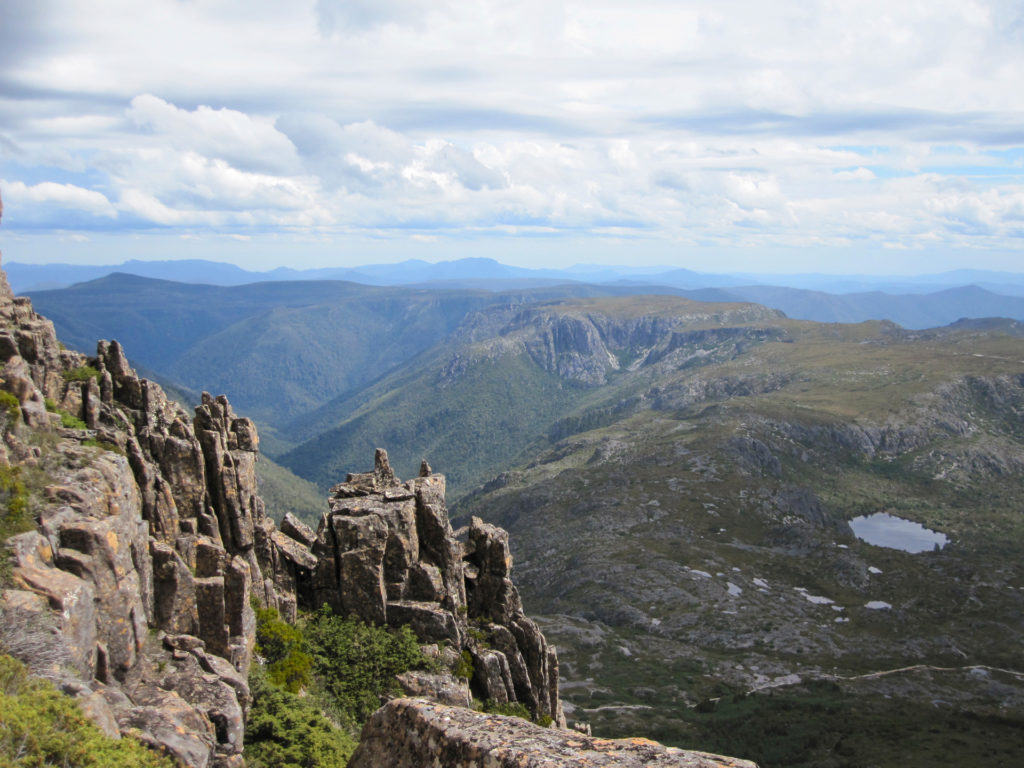
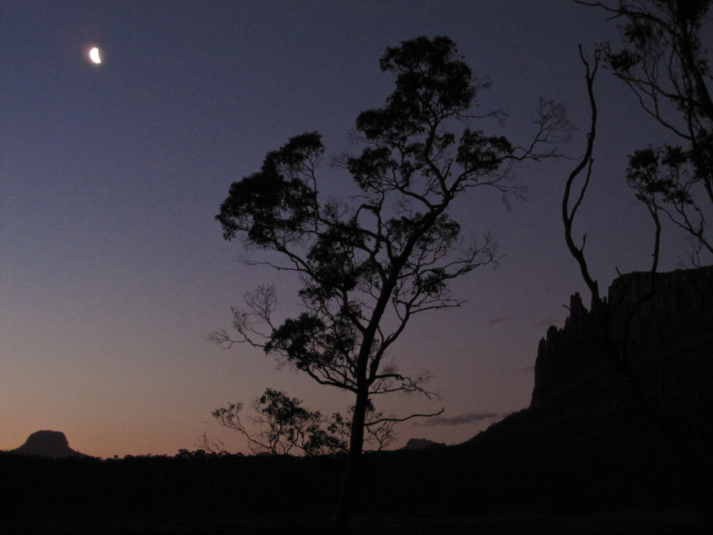
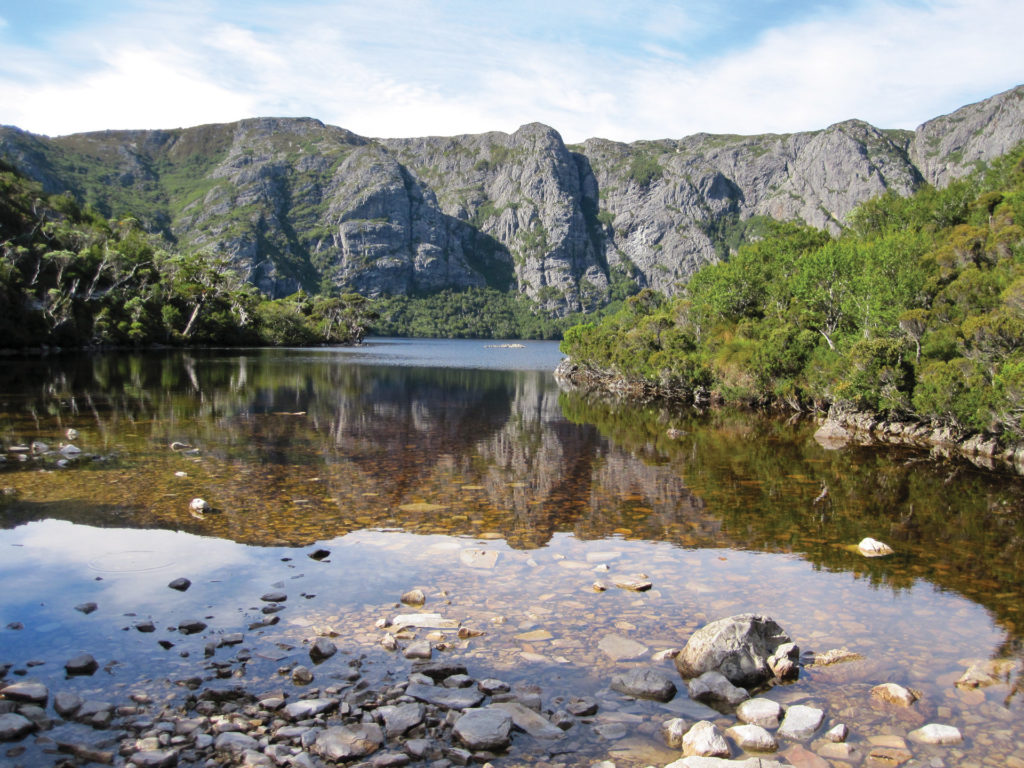
Maintained by the Tasmanian Parks & Wild life Service, the OT is a fantastic introduction to long-distance walking, with well-spaced and well-appointed huts, easy to follow track markings, numerous exciting side trips, bountiful wildlife and gorgeous scenery. Upland plateaus are dotted with glittering glacial tarns; alpine moorlands and buttongrass plains are spread wide; forests of native deciduous beech turn gold in the autumns; and peaks, cragged and serrated, pierce the sky.
In some ways it feels almost un-Australian, so distinct is it from anything on the mainland. Well-organised yet still wild, the hike is usually completed over six to eight days, but side-trips can extend that considerably. The distance is often quoted as 65km, but that’s only to the ferry at Narcissus Hut; the full walk is 80km. With the side trips described (and there are others not mentioned), this can rise to approximately 109km.
-

Location
Tasmania
-
Distance
109 km
-
Duration
8 Days
-
When to go
Year round is possible; recommended Oct-May.
-
Sleeping
Bring your Tent
-
Permit required
Yes. Independent walker numbersare capped at 34.
History
Australians have been walking for pleasure here since the early 20th century, an activity accelerated by the creation of two scenic reserves in 1922- one around Cradle Mountain and one around Lake St Clair. In 1928 the boards of the two reserves came together in support of a path to link them, a so-called ‘overland track’, but it was not until 1931 that local trapper Bert Nichols marked a trail through the region. Funds were provided and a track suitable for tourists and pack horses was completed in 1937. Commercial guided trips really only took off in the 1970s, with approximately 1500 hikers per season. In 1982, this area and three other parks in Tasmania were inscribed on the World Heritage List, now known as the Tasmanian Wilderness World Heritage Area. Today, hiker numbers can be as high as 9000 per year, with most visitors coming from interstate (60%) or overseas (30%).
When to go
The walk is split into two seasons. During the so-called booking season between 1st October and 31st May, walkers must walk from north to south (hence the orientation of these track notes) and must book a starting date. With the walk so popular, places are limited during this period to 60 per day, only 34 of which are reserved for independent walkers. Dates around Christmas and New Year fill up quickest but April is also popular with trekkers wishing to witness the glorious colours of the beech trees in autumn. Outside the booking season, hikers are welcome to walk any direction they please and don’t need to book.
Of course, the high season provides the best chance of good weather but it must be remembered that high winds, rain and snow can occur at any time of year, so clothing and equipment should be carried for all potential weather events. Tackling the Overland in winter is a much more serious challenge. The snow can be metres deep, obliterating trail markers and hut access. Anyone undertaking this must be experienced in navigation and snow camping, and should be equipped with snowshoes. For reference, the trip described in these notes was undertaken in the month of March.
Access
Cradle Mountain Visitor Centre, where walkers must register before starting, is about 2½ hours drive from Launceston , as is the finishing point at Cynthia Bay. Since most visitors will not be from Tasmania and thus won’t have generous relatives or friends to drive them around, the planning of transport is essential. Car shuffles involve tortuous three hour drives, so most independent hikers use bus services. Private bus companies such as Overland Track Transport and McDermott ‘s Coaches run dedicated transfer services, but at $125 to $150pp for both legs they’re not cheap. The public bus service Tassielink is slightly easier on the wallet but has a baffling website and services don’t run daily. Their early morning departure from Launceston runs four days a week; it also costs just $61.50. Services also exist from Cynthia Bay back to Cradle Mountain for those who have left their car there. Rather than list all options here, subject as they are to change, it’s best doing your own research when you’re ready to book. The ‘planning’ page on the NPWS website is a good starting point. Once at the visitor centre, there ‘s a shuttle bus to take you the seven kilometres to the actual start point at Ronny Creek. It runs regularly seven days a week from September to May.
Costs
During the Booking Season , hikers must pay the Overland Track fee-$200 for adults and $160 for children/concessions. This money goes towards paying staff and maintaining the track and huts. Walkers at any time of year must in addition have a Tasmanian National Parks Pass. There are various options for purchasing this, including the 8-week Holiday Pass, which costs $30 for a single person or $60 for up to eight people plus a vehicle.
Equipment
The NPWS website has a comprehensive gear checklist. Depending on your packing skills and preference for luxury over back pain, expect to be carrying 15 to 20kg when departing. Don’t forget a small summit pack to take essentials with you on side trips , and remember gas canisters cannot be taken aboard aircraft but can be purchased at the Cradle Mountain Visitor Centre and from some shuttle bus companies.
Navigation
Tasmap publish a perfect Cradle Mountain – Lake St Clair waterproof map which covers the entire walk at 1:100,000 , certainly large enough scale for navigation when combined with the ample signage. The map’s reverse side has notes and information on planning, safety and ethical camping. The route is also covered in 1:50,000 scale topographical by Tasmaps; you’ll need TL05 (Murchison) , TL06 (Jerusalem) and TM06 (St Clair). In 1:25,000 scale you’ll need 4038 (Cradle), 4037 (Will), 4036 (Achilles), 4236 (Cathedral), 4235 (Du Cane), 4234 (Olympus) and 4233 (Rufus).
Safety
The Tasmanian wilderness’s main danger is exposure to inclement weather. Storms can happen at any time; midsummer snow is not uncommon. If soaked in cold temperatures, hikers face the risk of hypothermia. The solution – always carry clothing and equipment for any conditions. And if you are benighted, make camp. Snakes inhabit the area, so wear sturdy gaiters, make noise as you go, and don’t forget compression bandages for your first aid kit. Some summits involve mild to serious scrambling, the danger of which is exacerbated in bad weather. Hike to your ability. Turn back if the weather deteriorates. Bushfires can also occur in the summer; know what to do in that event. Other minor irritations include leeches, jumbled tree roots which contribute to falls, and currawongs- wily birds that will open your pack and steal your food in a moment’s inattention.
Accommodation
Accommodation on the track is a series of basic huts (some more basic than others) and camp sites. Specific bunks and sites cannot be reserved; it is up to the individual to choose each night where they would prefer to sleep. Sleeping bunks range from individual or double cots to full-length shelves where sleepers lie side by side. It is recommended to bring inflatable sleeping mats as the bunks are bare wood, as well as ear plugs for obvious reasons. All huts have cooking benches, compostable toilets (bring your own toilet pape1~ plus a trowel for between-hut emergencies), water tanks (bring purification), and coal or gas heating (which is only permitted when the temperature drops below 10°C). Most main camping sites are platforms – wooden decks large enough for two two-person tents , pitched by attaching the corners and guy lines to snap-hooked chains instead of pegs. It’s weird but it usually works, and it’s a good idea to bring several lengths of sturdy cord to help tie in. Don’t leave the pegs at home though; some lesser -used sites are on regular ground. The nature of the booking process (start date only) means that there may well be more hikers than bunks on any given night, therefore it’s compulsory for all people to carry tents even if they’re planning on sleeping in a hut every night.
Other tips and tricks
While most people walk the track independently, a quarter of visitors use dedicated guide services. These can vary from fully-catered tours in private huts with wine and freshly- baked bread, to self-guided itineraries which take careo f all irritating logistics-such as transport and food – but leave you to make your own way along the track.
Try:
More Adventures like this
-
The Thorsborne Trail on Hinchinbrook Island, Queensland, is rated as one of the best multi-day hikes in Australia, and features in Lonely Planet’s “Epic Hikes of The World.” Just a few hours dri...
Thorsborne Trail
Hinchinbrook Island, QLD
-
The Larapinta Trail is one of Australia's finest walks, situated just out of Alice Springs and spanning 223kms across the West MacDonnell Ranges.
Larapinta Trail End to End
Central Australia
-
A five day walk in the northern Flinders Ranges, uncovering the very best of South Australia’s unique and varied northern outback wilderness.
Arkaroola Wilderness Sanctuary
South Australia
Related Stories
-
- our stories
26 August 2020A lightbulb moment: The story behind Wejugo
Meet Mike Welling - a passionate adventurer, biologist and environmental advocate with a strong belief that the most valued things... -
- our stories
7 October 2020The importance of sustainable travel
Sustainable travel takes into full account of the destination’s current and future economic, social and environmental impact so... -
- our stories
17 September 2021 |What does sustainable tourism mean anyway?
Sustainability. Environmentally-friendly. Leave No Trace. These words and more are thrown around 24/7, but what do they actually m...
