

Bikepacking the Queen Charlotte Track
Marlborough Sounds, New Zealand


What could be better than hiking the stunning Queen Charlotte Track? If you’re a passionate mountain biker, there’s only one answer.
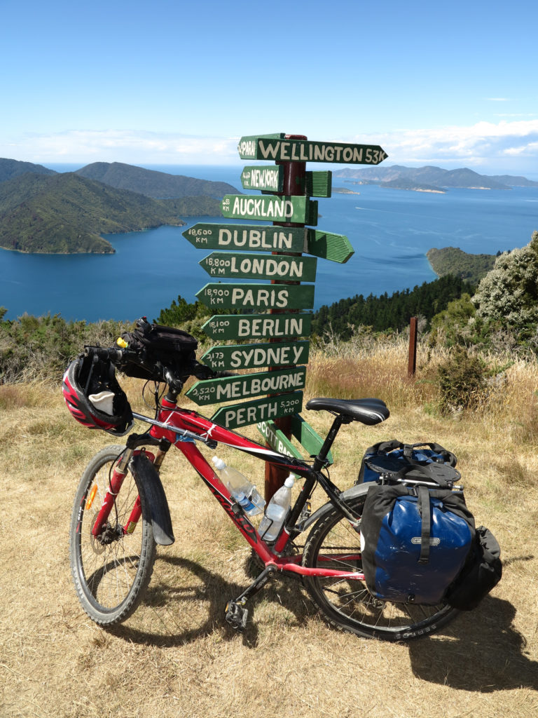
There’s no doubt about it – Queen Charlotte Sound, just outside Picton, at the top end of New Zealand’s South Island, is one of nature’s treasures. Azure water hemmed in by verdant fingers of land in a coastal work of art, who wouldn’t want to explore it by human power?
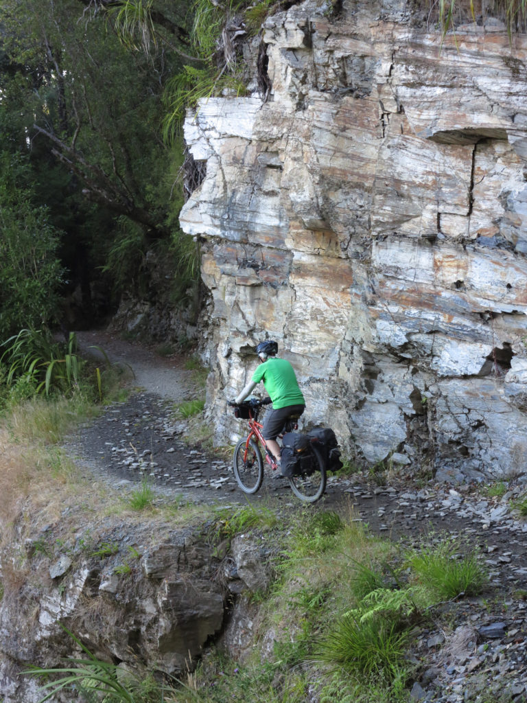
In biking terms, the Queen Charlotte Track (QCT) is the longest section of single track in NZ. It combines proper gnarly ascents and descents with plenty of hillside exposure, heart-palpitating drop-offs, technical switchbacks and pure grunt work, all within a network of campsites and accommodation in a gorgeous year-round climate. What’s more, you don’t even have to carry your luggage if you don’t want to. Chuck your bags on the daily boat service and treat it as a series of day rides. It’s win-win-win.
-

Location
Marlborough Sounds, New Zealand
-
Distance
73.5km
-
Duration
3 Days
-
When to go
March to Nov (Full Track) Year Round (Camp Bay)
-
Sleeping
Camping, Backpackers, Cabins, Lodges
-
Permit required
QCTLC
Highlights
- The downhill singletrack sections, naturally.
- The view from Eatwell Lookout is the visual highlight of the track, and possibly your life.
- Riding completely unencumbered by luggage.
- Cooling off with a swim in one of the cute little bays on a baking day.
- The boat ride through the Sound alone is one that draws visitors from across the globe.
History
The Sound itself is of great historical importance. Totaranui, as it is known by the Māori, was the site of the first friendly contact between the indigenous people and Captain Cook. It was at Ship Cove that he first stepped ashore. As the area became settled by colonists, Kenepuru Ridge became a natural bridleway for transporting livestock and wool, and it was in the early 1980s that the idea of a recreational walking track first emerged.
It was opened in 1983 but poorly maintained until the formation of the Department of Conservation (DOC) in 1987. Four years later, it was officially opened as the Queen Charlotte Walkway, and although cyclists have always been around, it was in 2013 the Queen Charlotte Track was named New Zealand’s 21st ‘Great Ride’.
The route
The Queen Charlotte Track is a shared trail, with mountain bikers forming a large proportion of trail users, and numbers growing healthier year-on-year. It can technically be ridden in either direction, but 99% of users start at Ship Cove and end at Anakiwa. The reverse makes it harder to time your boat transfer, and will also increase the probability of meeting other bikers and walkers head on.
Ship Cove to Camp Bay – 28.5km This is the narrowest, most hectic singletrack, but it’s also the busiest section, with many walkers tackling it as a day trip. A couple of steep hills will get your lungs blowing but the resultant downhill is tremendous fun, before a cruisy second half leads around Endeavour Inlet into Camp Bay.
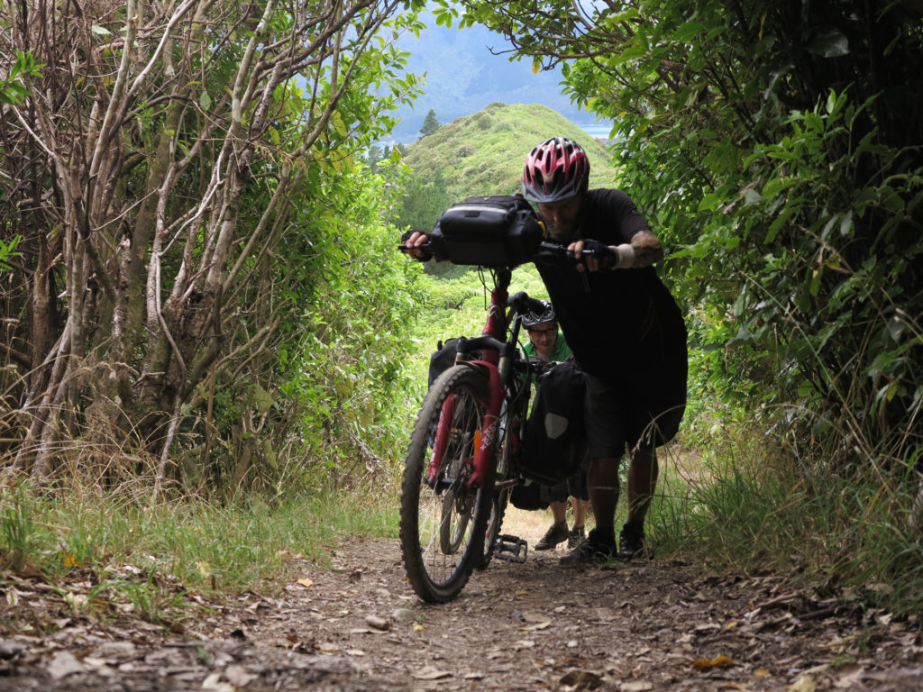
Camp Bay to Cowshed Bay – 24.5km This is the main Kenepuru Ridge section, where your legs will really earn their place on your body. You can expect to be doing a fair bit of pushing today, but when you break out of the trees at Eatwell Lookout, it’ll all be worthwhile. Those without a head for heights can take the sea-level Kenepuru Road for the day instead.
Cowshed Bay to Anakiwa – 20km The morning ascent out of the bay will be like a rude slap in the chops, but persevere and it’ll ease off after the crest with some undulating elevation. There’ll be more day walkers to dodge heading into Anakiwa as you coast back onto the mainland.
Access
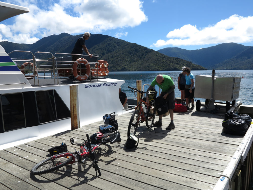
Unless you have your own boat and captain, or are a very good swimmer, you’re going to need a lift to Ship Cove, which is inaccessible by road. From Picton, there are a number of operators that ferry hikers, bikers, day trippers and locals out to various points on the peninsula. You can catch the same boat back to Picton from Anakiwa, or just blast out the hilly 23km road ride as an encore.
When to go
Most of the QCT is open all year round to hikers and bikers alike. However, the first section, between Ship Cove and Camp Bay, is closed to cyclists during the busy summer season (start December to end February). This is due to the narrow and steep nature of this part of the route, along which out-of-control riders might pose a danger to walkers (as well as themselves). The months directly before and after this trimester are the busiest times for the cycling fraternity.
Navigation
You’d have to be a navigational black hole to get lost on the Queen Charlotte Track. There are signposts to accommodations and points of interest, but otherwise, point your handlebars west and stay off the tarmac.
Equipment
You’ll need your regular bikepacking set up, with a set of modern frame, tube and seat bags being far preferable to panniers, which tend to throw you off balance on steep and windy descents. Any decent bike will do, as long as it has a plethora of gears to slip through as the gradient rises from ‘Holland’ to ‘Nepal’. In New Zealand, e-bikes are not permitted on tracks graded 4 and above, which cuts out pretty much all of the QCT. There are no repair facilities along the way, so you’ll need a set of tools and the knowledge to use them, or you might find yourself walking to the next jetty. Picton is a large town where you can buy all the supplies you’ll need.
Accomodation
With this being such a popular track, there are numerous options for accommodation. Six basic DOC campsites provide places to lay your head along the way, for which you’ll need to carry all your equipment, including stoves and fuel, and carry out your rubbish. It’s recommended to book these in advance if possible via the DOC office in town i-SITE. Private options range from camp sites to backpackers to cabins and luxury lodges. Go where your budget takes you!
If you’re a real pro speedster, it’s possible to complete the whole track in one day. Just make sure you don’t endanger other trail users in your attempt!
Costs
To get to the start of the Queen Charlotte Track, we used Cougar Line, with whom a one-way transfer is $80, plus $5 per bike. If you’ve had enough of riding by the time you get to Anakiwa, Picton is $50 by scheduled boat service. You can also get both legs plus a daily transport service for your bags from campsite/lodge to campsite/lodge, for $120.
As parts of the track cross private land, users will also need to purchase a Queen Charlotte Track Land Cooperative Pass for $25 (multiday use).
DOC Campsites vary in price, starting at $6. For private campsites and lodges, the sky’s the limit.
Trail etiquette
Normal mountain biking safety advice should be followed, i.e. don’t bomb headlong down 45° slopes like Rachel Atherton on Red Bull, but trail courtesy is doubly important on a shared trail. Don’t scream up behind walkers and brake in a cloud of dust. Don’t hare past them with inches to spare. Ring your bell as you approach, (not an industrial air horn), and the lead rider should communicate how many riders are in your group. Ride to your skill level and everything will be peachy.
Useful links:
Queen Charlotte Track – New Zealand
QCTLC Pass info – http://www.qctrack.co.nz/track-info/qctlc-pass/
https://www.doc.govt.nz/parks-and-recreation/places-to-stay/stay-at-a-campsite/
More Adventures like this
-
Hiked Kosciuszko's Main Range circuit in summer, and think it’s done and dusted? Think again! The same route in winter, in below-freezing temperatures, is a whole different story.
Snowshoeing Kosciuszko
Kosciuszko National Park, NSW
-
There are only a few places in the country that are widely known and respected as nationwide hubs for mountain biking, and Bright, Vic, is one of them. Next time you’re passing through High Country...
Mountain Biking in Bright
High Country Victoria
Related Stories
-
- our stories
23 October 2020How Wejugo is shaping sustainable adventure travel
We sat down with our chairman and leading adventure travel expert, Tim Macartney-Snape, to find out why he decided to take on the... -
- our stories
7 October 2020The importance of sustainable travel
Sustainable travel takes into full account of the destination’s current and future economic, social and environmental impact so... -
- our stories
12 August 2021 |Winter canyoning - now who's ready to plunge into near-freezing waters?
It has been said* that Australians, as a nation, are scared of cold water. So who in their right mind would willingly plunge their...
